

Home : 1854 Map Extracts
1854 Ordnance Survey Map Extracts
Grassholme
1854 OS map extract showing detail of the area of the 'new' Grassholme bridge and the old packhorse bridge (now submerged).
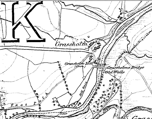
Historical map of Yorkshire, sheet 004, last modified in 1854
Selset
Map extract showing some of the land area now covered by Selset Reservoir including Low Wemmergill, Thwaites, Turner Holm and Bink House.
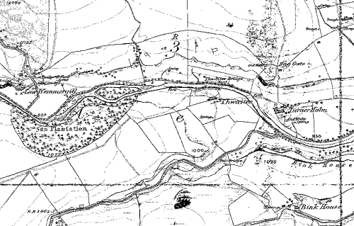
Historical map of Yorkshire, sheet 004, last modified in 1854
To obtain a printed or digitised copy of the full 1854 OS map go to http://www.bgs.ac.uk/, The British Geological Survey web site.
